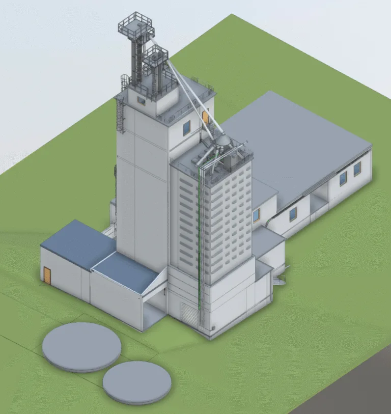
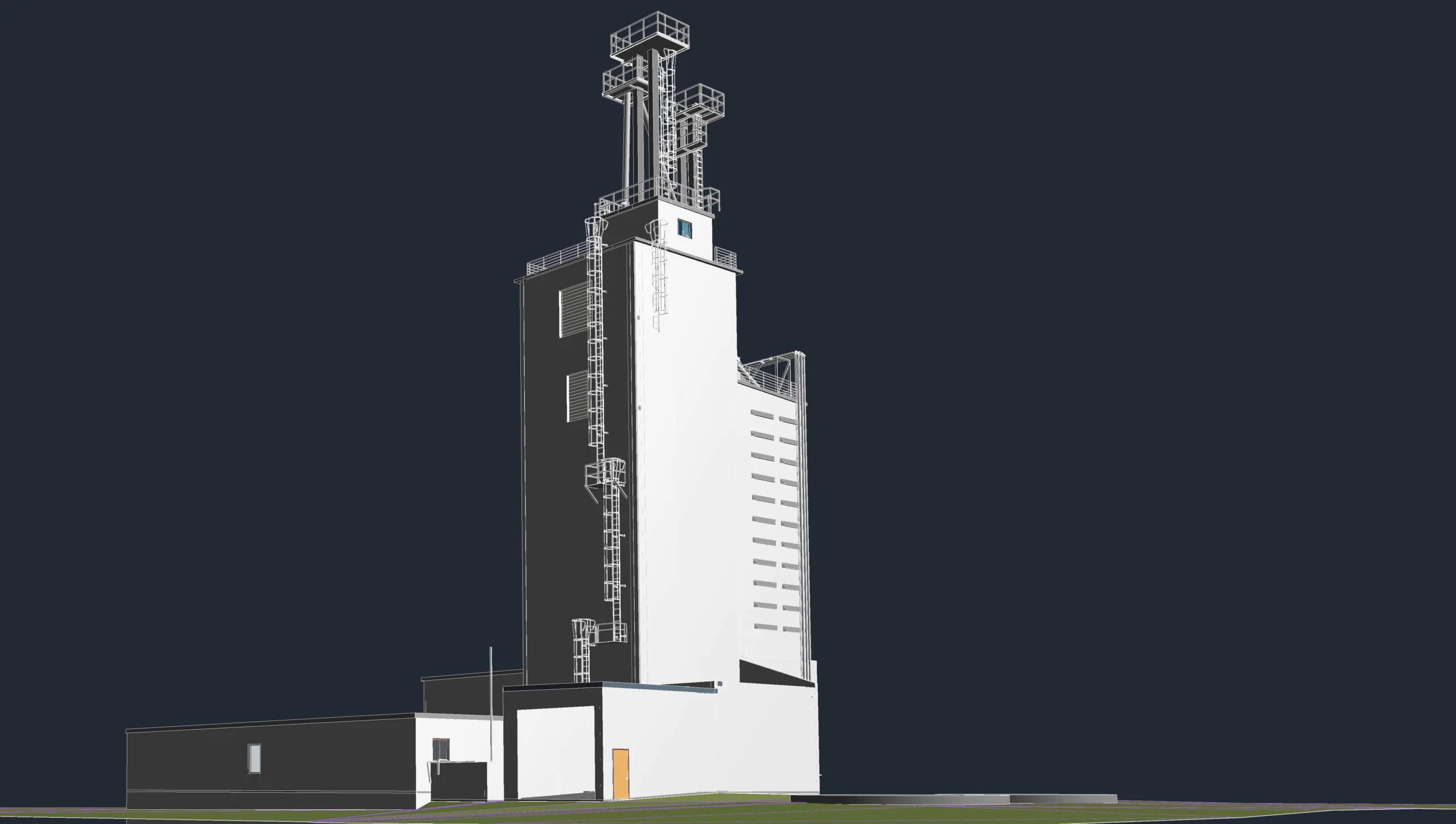
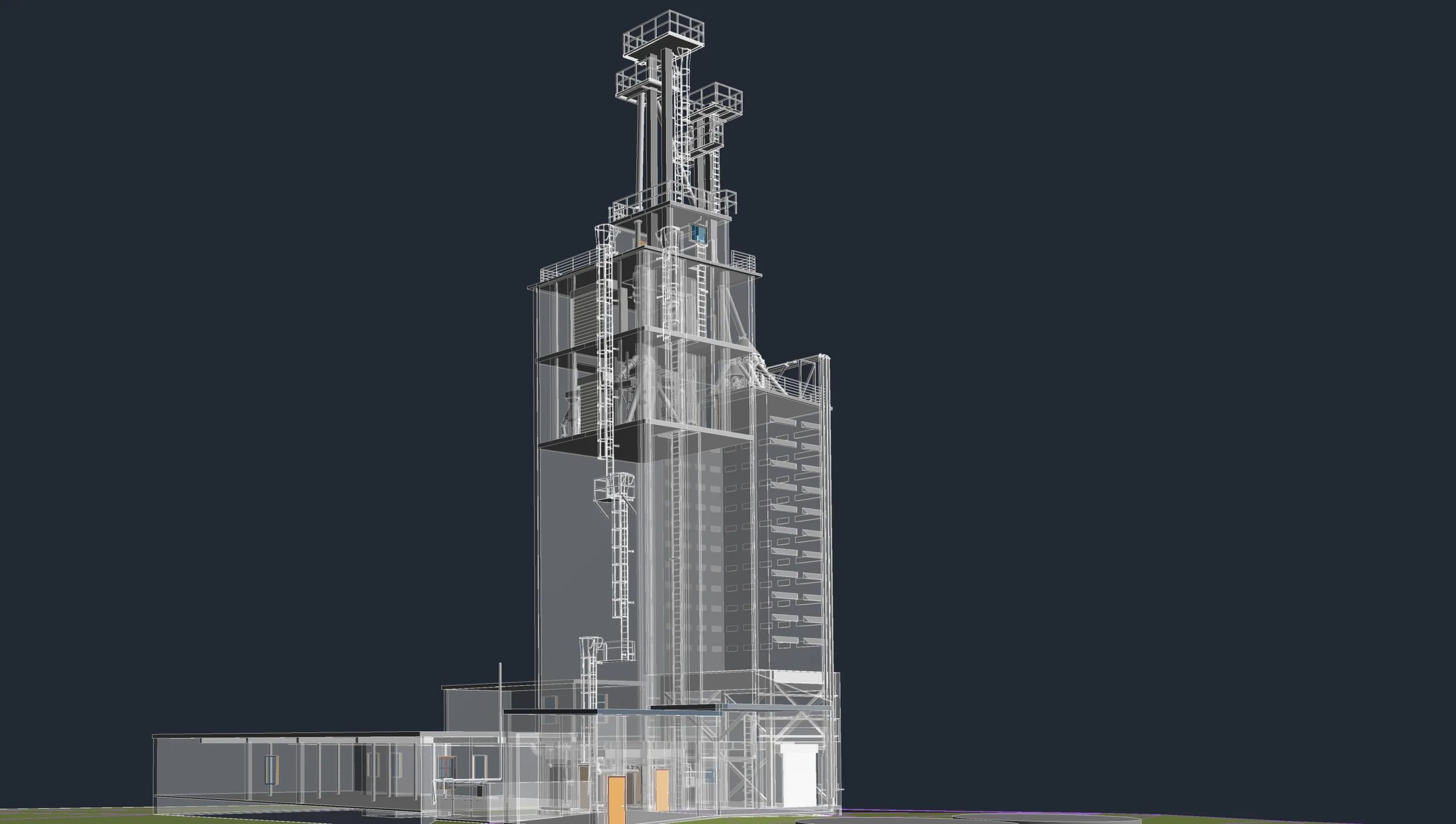
Commissioned by one of the largest surveying companies in the USA to develop a BIM model from point cloud data for an old, non-functioning industrial facility. The site included multiple structures, with a primary focus on a large industrial silo and surrounding buildings. The objective was to generate an accurate digital representation of the existing conditions to support the planning and restoration of the facility, with the goal of reviving production operations.
Scope and Deliverables:
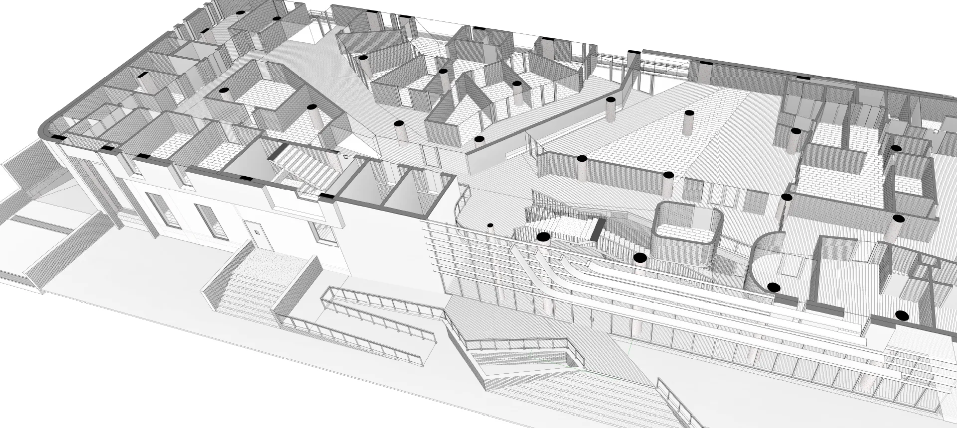
Our scope included the creation of a basic LOD 200 BIM model, capturing both architectural and structural elements across all relevant buildings on site. The modeling was based entirely on high-resolution point cloud data captured by the survey team. Using Autodesk Revit, we extracted geometry for key components including silo tanks, platforms, structural framing, floor slabs, staircases, and external building envelopes.
The challenge lay in interpreting and modeling the aged and deteriorated structures from point cloud data where physical distortions and missing elements were common. Special attention was given to ensuring structural components were modeled in a way that allowed engineers and architects to evaluate the feasibility of refurbishment and reinforcement.
Key Activities:
- Point cloud data registration and segmentation
- Modeling of silo structures, surrounding industrial buildings, and connecting infrastructure
- Capturing key structural alignments and levels for design reference
- Coordination with the client’s survey team to validate critical dimensions
The final model provided a reliable digital base for future design interventions, structural analysis, and space planning. It served as a vital tool in assessing the site’s readiness for redevelopment and in supporting the engineering team’s decision-making for restoring operational capacity.